Migratory Pollinators Program
STUDY AREA
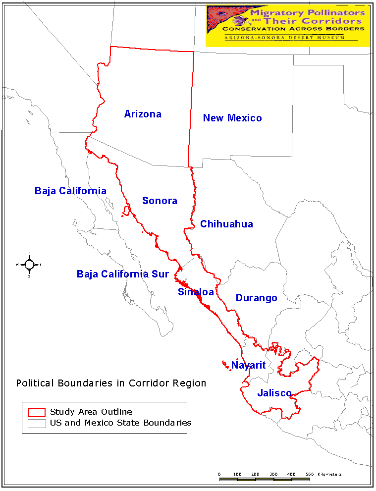
In order to study long-distance migratory animals along their travel corridors, a regional, international, multi-scaled approach is required. For some species, this could mean a study corridor of hundreds or even thousands of kilometers. Studies of long-distance migrators are further complicated by the fact that animals tend to vary their route from year to year due to interannual variations in climate and/or floral resources. Our study addressed four pollinator species, each with its own distinct migratory routes of variable length and geography, and unique natural history. In addition, the migratory corridors that we studied cross political borders. Political boundaries pertinent to the corridor region of this study are shown on Map 1.
 |
| Map 1. Click for full size map with key |
Our
study area covered 1,660 km (straight-line measurement) from central Jalisco to
southern Arizona. Thus, great efforts were made to establish cooperative
and collaborative partnerships between countries and states, national and local
governments, state and federal agencies, municipalities, public and private landowners,
a binational team of scientists, and individual citizens.
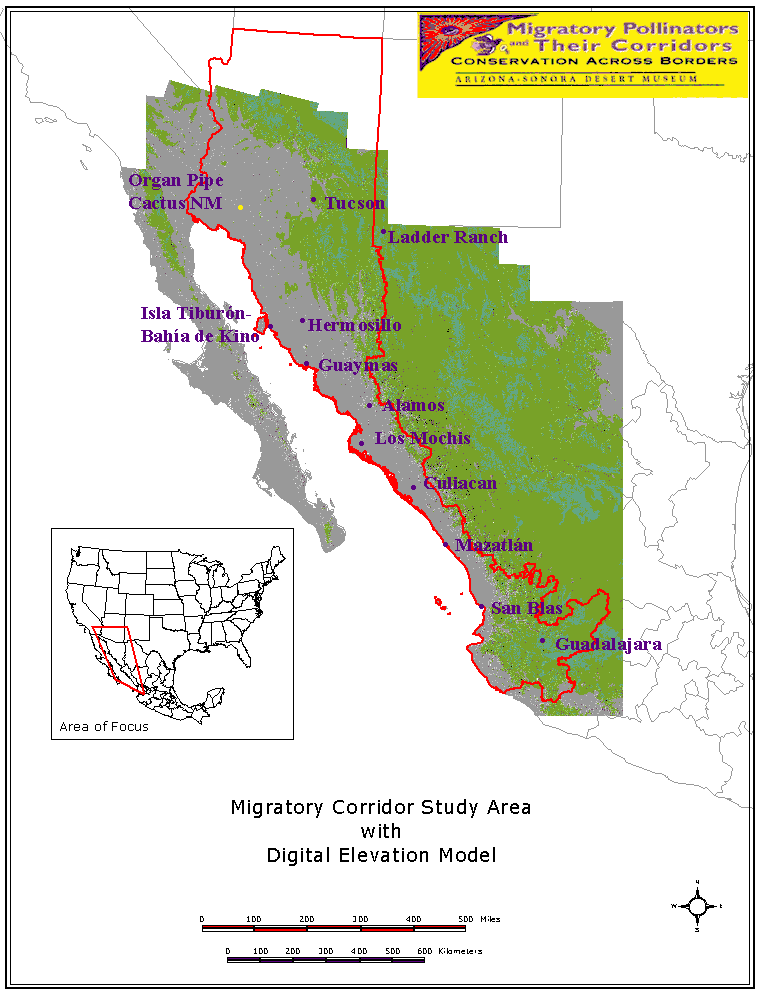
Our study initially focused on 19 regional sites, but later expanded to include others deemed important for effective monitoring of the four target pollinator species (Map 2).
 |
| Map
2. Click for full size map with key |
Examination
of the geography of our study area (Map 2) reveals that the distance between the
coastline (Sea of Cortez) and the edge of the Sierra Madre Occidental mountain
range narrows dramatically in one region of the corridor. Since our study
species rely on specific plant species that grow at particular elevations, their
floristic resource availability becomes more competitive in this narrow region.
We have identified this as a "corridor funnel." The funnel narrows to just
50 km in the Nayarit/Jalisco area. Animals have less geographic area available
to them in this region and therefore more competition among plant resources exists.
This narrow strip therefore has a higher potential risk of habitat fragmentation
so the conservation strategies in this region of the corridor are more challenging
than in areas to the north or south.
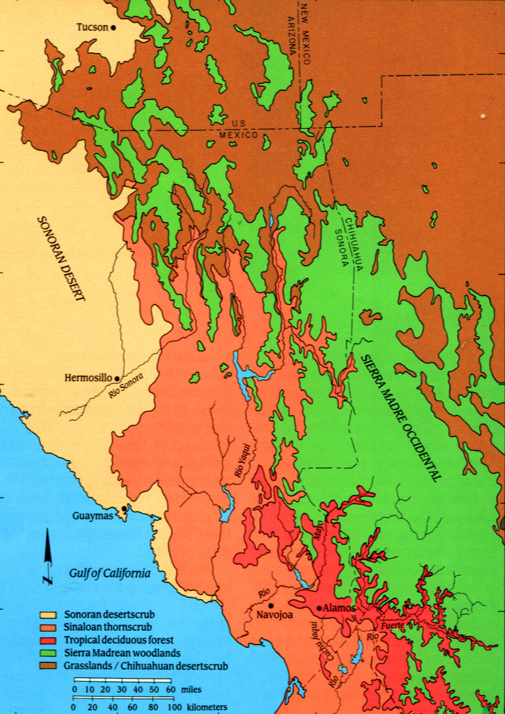
This study also covered several different and quite distinct ecoregions (Map 3), including the Sonoran Desert, Chihuahuan Desert, Tropical Dry Forests, and Montane Forests. The migratory passage through the Sonoran Desert is the largest region in the Corridor. The Sonoran Desert receives significantly less rainfall and is typically at much lower elevations than the other regions in our study, although the rains are biseasonal (winter storms and summer monsoons, separated by spring and fall drought periods). Rainfall averages 3 to 12 inches (76-305 mm) annually, depending on area. The driest regions (Lower Colorado River Valley, Central Gulf Coast, and Plains of Sonora) are the most heavily traveled. Migrators passing through this arid desert have a critical dependency on the floral and other natural resources. Here, all four species overlap in their floristic resource utilization. White-winged doves are closely associated with columnar cacti and are particularly connected to saguaro cactus communities, but are also consumers of grains and utilize agricultural sectors of the corridor more than the other three species. Lesser long-nosed bats rely heavily on both columnar cacti and agave species. Hummingbirds and monarchs feed on a wider variety of flowering plants than the other species.
The Chihuahuan Desert differs from the other areas in the corridor in being a warm-temperate ecoregion. It gets more rainfall (except in some of the eastern portions) and is higher in elevation than the Sonoran Desert, experiencing cold winters with hard freezes. Rains come mainly as summer monsoons, but these bring 8 to 12 inches (203-305mm) annually. The western portion of the Chihuahuan Desert ecoregion is important in many of the southward migrations of pollinator species. Tropical Dry Forests are typically higher in elevation and are composed of denser, more abundant trees and shrubs than in the Sonoran Desert or Chihuahuan ecoregions. Montane Forests in this study include high elevations throughout the Sierra Madre range and are used by lesser long-nosed bats and hummingbirds.
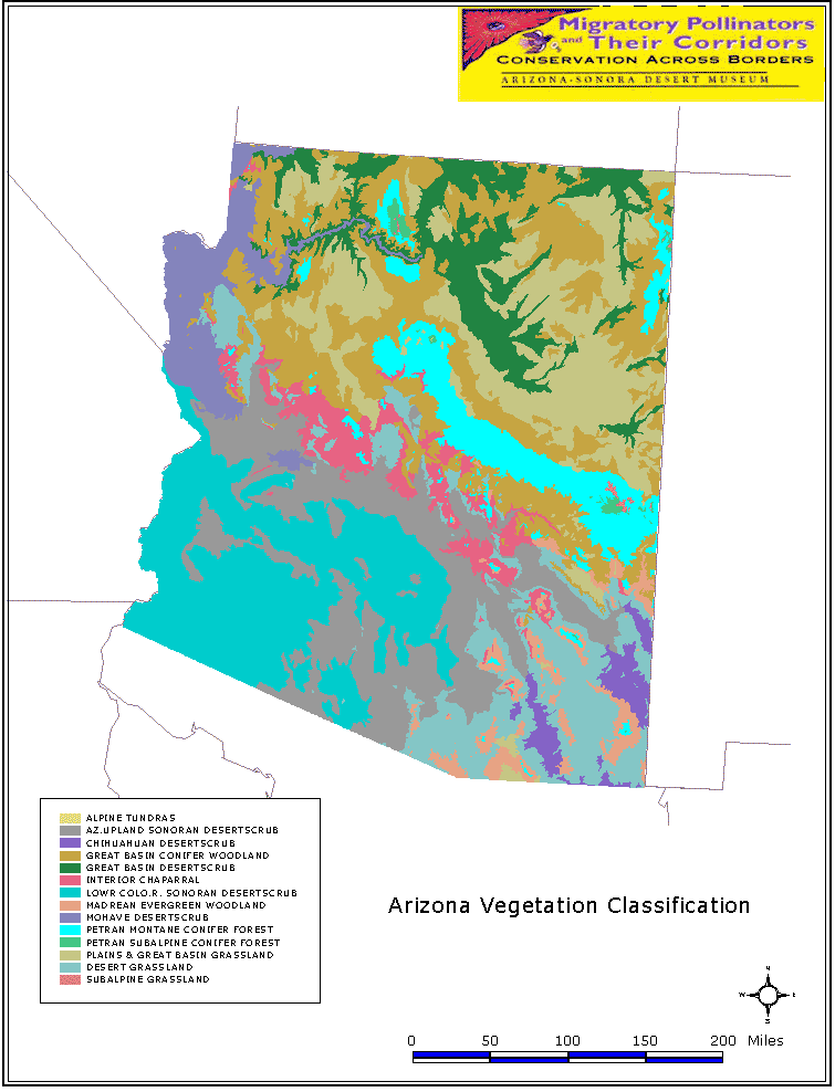
Vegetation classifications for the regions are shown in Maps 3 and 4.
 | 
|
Map
3. Click for larger version | Map
4. Click for larger version with key |
 |  |
Map
5. Click for larger version with key | Map
6. Click for larger version with key |
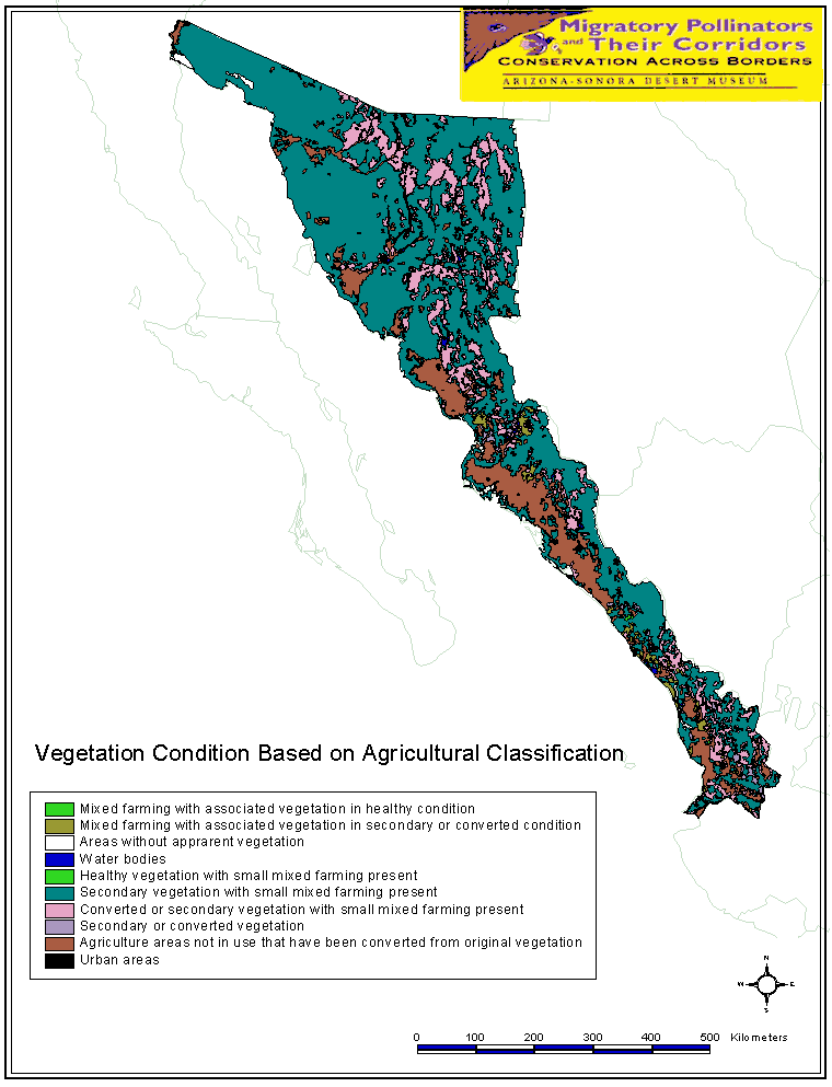
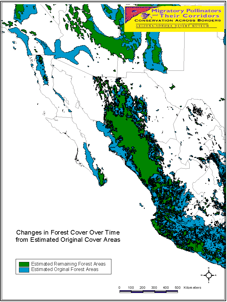
Many natural habitats in the migratory region have been converted to agriculture or subjected to fragmentation due to urbanization. Map 5 shows vegetation condition based on conversion of natural habitats. Map 6 displays the changes in forest cover over time.
Top of Page | Previous Page | Next Page